Media Room
|
: 10 : Admin : Wed, 3 August 2016, 12:00 AM |
| 6 Stories of Maps |
|---|
|
6 Stories of Maps By Shin Sang-hee, CEO of Gaia3D, Inc. & Board of Directors of OSGeo Foundation
_신상희.png) CEO Shin Sang-hee of Gaia3D, Inc. 1. Suwon, Korea At the beginning of July, the Korea National Geographic Information Institute (NGII), a national mapping agency based in Suwon, announced that it will give away around 50 thousand sheets of 1:1,000 large scale digital maps to the public. The NGII now provides approximately 660,000 maps to the public for free. This was widely accepted as a huge achievement toward Government 3.0 initiative. And this decision was expected to give tremendous monetary benefits to Korean users, who previously had to pay for maps. As a side note, it is still very hard to take Korean maps out of the country, as you see the recent controversy over Google’s request. However, to some geospatial experts, this decision was perceived as another symbolic sign of the commoditization of maps. If you look around, you may find lots of free map services. You use Google, Naver and Daum maps for travel planning, car navigation and finding places without paying a cent. People now take free maps for granted. Whether map producers like it or not, this trend is inevitably true. Maps are getting cheaper and cheaper, and are getting commoditized to the point of demonetization eventually. The demonetization of maps usually comes when map providers realize the fact that a free service will create more value than paid one. Google, Naver and Daum provide map services for free and create value from advertising. Likewise, NGII’s giving away maps will stimulate geospatial SMB’s business and eventually help the Korean economy.
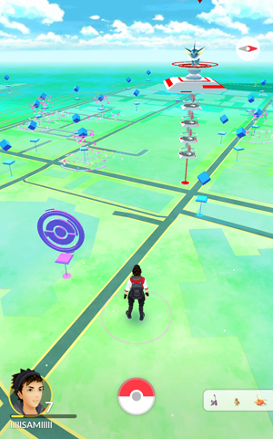
2. Sokcho, Korea “Maps, maps, maps! We need maps!” It’s not the chant from a revolutionary mob. It’s from Korean Pokemon Go players. To catch those cute Pocket Monsters using augmented reality technology on mobile phones, there must be the maps for the playing area. However, Pokemon Go has not been released and playable yet in South Korea, like most of other Asian countries, except in the Sokcho city area. Due to skewed diamond style mapping cells, a small area around Sokcho is considered a part of the North Korea mapping region by Niantic, the developer company of the game, and this glitch makes the game fully playable in that area. Numerous people have rushed to Sokcho to play the game and express bus tickets from Seoul have been sold out. Ironically, not releasing Pokemon Go in Korea reminds us of the importance of maps in our daily life. Surprisingly, just one game awoke us to realize how important maps are. We can’t even enjoy a game without maps! Let’s imagine that if you don’t have any accessible map services around you, or if you are not satisfied with the quality of maps, what would you do? 3. London, U.K. Traditionally, maps had been the exclusive property of the people or organizations with power and wealth, because they required a lot of money, skilled persons and complicated equipment to survey areas and publish maps. That’s why only national mapping agencies such as NGII, USGS and commercial companies like NavTeq, Google and Microsoft provided map services before the start of OpenStreetMap (OSM). In 2004, Steve Coast, then a 24-year-old computer science student at University College of London (UCL), had some dissatisfaction with maps. Government funded national mapping agencies created massive map datasets, however they failed to freely and widely distribute those mapping datasets. And commercial map data had many legal limitations and license issues to use freely. Steve founded an OSM project to tackle these limitations by applying Wikipedia-style culture and technology to map producing. OSM is a wiki map of the world. It's like Wikipedia, but it is a map. So anybody can add roads and buildings instead of text articles. In April 2006, the OpenStreetMap Foundation was established to encourage the growth, development and distribution of free geospatial data and provide geospatial data for anybody to use and share. Ten years later, the achievements have been terrific! It now has more than 2 million registered mappers and they map all around the world. The total length of roadways in OSM is now longer than that of commercial car navigation maps. OSM started to support turn-by-turn navigation and finally was installed in real car navigation systems. In 2015, the world largest carmaker, Toyota, selected TeleNav as its Brought-In Navigation supplier, with OSM maps being the first use of OSM by a car manufacturer. The OSM project has now been extended to OpenIndoorMap, OpenSeaMap, OpenHike and Bike Map. In short, with OSM, anybody can map the world without a huge amount of money and complicated equipment. It has been seen as the democratization and decentralization of mapping power. 4. Eastern Visayas, Philippines OSM has more than 2 million registered mappers, but only a fraction of those are active mappers. If we could mobilize them to map the area where quick response is very critical, we could produce maps very quickly. The Humanitarian OpenStreetMap Team (HOT) do just that. Up-to-date free maps are very critical resources for relief organizations when they are responding to disasters or political crises. The HOT team does that by making and providing maps for them. From the early days of OSM, many OSM members thought that open, free map data could help humanitarian jobs, and the idea was proved during the 2010 Haiti earthquake. After the great success of producing a relief map for Haiti, the HOT team was established as a legal entity. On Nov. 8, 2013, Typhoon Haiyan hit and devastated portions of the Philippines, especially the Eastern Visayas area. More than 5,500 people were killed in the Eastern Visayas region by the typhoon, and quick relief was urgently needed. However, a lack of maps hindered the relief activities, so the HOT team jumped into action to make the most up-to-date maps for the affected area. It took only two weeks to complete the mapping of almost the whole affected area. HOT maps were used on the ground by aid agencies, such as the American Red Cross, which had equipped their teams with OSM maps. Now the power of maps helps other people survive. 5. Chicago, U.S. A map is just a dataset. However great it might be, a map is useless without software. It’s just like food and body relation. If you are not ready to ingest or digest the foods, healthy food is useless. Likewise, you should have special software called Geospatial Information System (GIS) to make, manage, analyze and publish maps. Commercial GIS software is usually expensive, and there are not so many other options. It means that whether you have free maps or not, you need to buy expensive software to do something with maps. Let’s think about how awesome it will be if we could develop GIS software in a collaborative way just like Wikipedia or OSM. That is FOSS4G (Free and Open Source SW for Geospatial)! Open source software is computer software with its source code made available with a license in which the copyright holder provides the rights to study, change, and distribute the software to anyone and for any purpose. In short, you can use, study, modify and even redistribute the FOSS4G freely. To support the collaborative development of open source geospatial software, and promote its widespread use in the world, the OSGeo (Open Source Geospatial) Foundation was established in 2006 in Chicago. For the last 10 years, OSGeo has played a key role to developing, promoting, and spreading the FOSS4G around the world. OSGeo now develops and manages around 30 geospatial software and has 49 local chapters all over the world. FOSS4G has been at the heart of many innovative geospatial startup business. Google also uses OSGeo’s project in its Google Earth program. One of the greatest activities from OSGeo is the annual International FOSS4G Conference. The annual FOSS4G conference is the largest global gathering that focuses on free open source geospatial solutions. The conference brings together developers, users, decision-makers and businessmen from a broad spectrum of organizations and fields of operation. As the FOSS4G conference has grown, now it usually takes place for six days. Here’s a question for you: Can you guess last year’s hosting city of the International FOSS4G conference.
SMART Geospatial Expo 2016 will be held at The-K Hotel in Seoul from Aug. 31 to Sept. 2. The SMART Geospatial Expo 2016 will coincide with the FOSS4G Korea 2016. 6. Seoul, Korea Many readers of this magazine may not know that last years’ International FOSS4G conference was held in Seoul in conjunction with the SmartGeospatial Expo 2015. It was the first time it was hosted in Asia, and was a huge success. Both events, the FOSS4G Seoul conference and the Smart Geospatial Expo, created very unique places for attendants to connect with different people, cultures and technologies by mixing two great events. This year’s International FOSS4G conference takes place in Bonn, Germany, so you may be sad that you can’t attend this unique opportunity this year. But don’t worry. There will be another reunion between FOSS4G and Smart Geospatial Expo this year. Where At FOSS4G Korea, a local conference that will be held in conjunction with SmartGeospatial Expo just like last year. FOSS4G Korea and Smart Geospatial Expo will take place from Aug. 31 to Sept. 2 at The-K Hotel. All the events are free. If you visit and attend these events, you’ll learn much about recent trends of geospatial technologies, such as open data, open source, smart city, point clouds and so on. There will be a special Smart City session on the first day of FOSS4G Korea, and renowned persons like Chris Pettit (University of New South Wales, Australia), Daniel Kastl (Georepublic, Germany), Steve Liang (University of Calgary, Canada) will attend and give talks. At the Smart Geospatial Expo, you might come across cutting-edge geospatial technologies such as drones, self-driving cars and 3D GIS. Attending both events will give you a very unique experience. |
| Back to list |